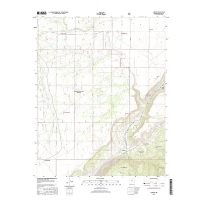
2017 Map of Carson
USGS Topo · Published 2017About this map
Rio Grande waters carve through the dramatic high-desert landscape of Taos County, where the river meets a series of steep canyons and technical water features. Near the village of Pilar, the river's character is defined by named rapids such as The Karmic Wave Rapid and The Narrow Rapid, which draw recreational interest to this section of the Cañon del Rio Grande. The surrounding terrain within the Carson National Forest is deeply etched by a network of drainage systems, including the Arroyo Aguaje de la Petaca and the Arroyo Noria.
Find a feature on this map
37 named features on this map. Tap any name to fly to it.
Don’t see what you’re looking for? This feature index may not catch every label — zoom into the map to look around manually.
Map Details
Editions of this 2017 Carson Map
This is the sole edition of this map. No revisions or reprints were ever made.
Other maps of this area

1953 · Velarde
USGS Topo · 1:24,000

1953 · Trampas
USGS Topo · 1:24,000

1954 · Raton
USGS Topo · 1:250,000

1958 · Raton
USGS Topo · 1:250,000

1960 · Taos Junction
USGS Topo · 1:24,000

1961 · Carson
USGS Topo · 1:24,000

1961 · Tres Orejas
USGS Topo · 1:24,000

1961 · Servilleta Plaza
USGS Topo · 1:24,000

1964 · Los Cordovas
USGS Topo · 1:24,000

1964 · Penasco
USGS Topo · 1:24,000