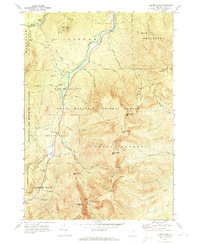
1970 Map of Carter Dome
USGS Topo · Published 1972About this map
The Peabody River carves through a landscape defined by the high peaks of the White Mountain National Forest in this 1970 study. The map detail highlights the development of the region's recreational identity, anchored by the Wildcat Mountain Ski Area and the historic Glen House site near the foot of the Mt Washington Auto Road. A network of backcountry infrastructure is visible, including the Appalachian Trail as it traverses the Carter Range across South Carter Mtn and Carter Dome.
Find a feature on this map
61 named features on this map. Tap any name to fly to it.
Don’t see what you’re looking for? This feature index may not catch every label — zoom into the map to look around manually.
Map Details
Editions of this 1970 Carter Dome Map
3 editions found
Other maps of this area

1893 · Mt. Washington
USGS Topo · 1:62,500

1893 · Gorham
USGS Topo · 1:62,500

1894 · North Conway
USGS Topo · 1:62,500

1895 · Crawford Notch
USGS Topo · 1:62,500

1896 · Mt. Washington
USGS Topo · 1:62,500

1896 · Crawford Notch
USGS Topo · 1:62,500

1896 · North Conway
USGS Topo · 1:62,500

1896 · Gorham
USGS Topo · 1:62,500

1935 · Mt. Washington
USGS Topo · 1:62,500

1937 · Gorham
USGS Topo · 1:48,000