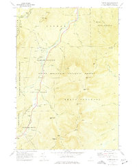
1970 Map of Carter Dome
USGS Topo · Published 1977About this map
The Peabody River valley serves as the primary corridor through this high-elevation landscape, where 18th-century land grants like Pinkhams Grant and Greens Grant define the administrative geography within the White Mountain National Forest. By the early 1970s, the area had solidified its identity as a premier recreational hub, centered around the Wildcat Mountain Ski Area and the base of the Mt Washington Auto Road at Glen House.
Find a feature on this map
60 named features on this map. Tap any name to fly to it.
Don’t see what you’re looking for? This feature index may not catch every label — zoom into the map to look around manually.
Map Details
Editions of this 1970 Carter Dome Map
3 editions found
Other maps of this area

1893 · Mt. Washington
USGS Topo · 1:62,500

1893 · Gorham
USGS Topo · 1:62,500

1894 · North Conway
USGS Topo · 1:62,500

1895 · Crawford Notch
USGS Topo · 1:62,500

1896 · Mt. Washington
USGS Topo · 1:62,500

1896 · Crawford Notch
USGS Topo · 1:62,500

1896 · North Conway
USGS Topo · 1:62,500

1896 · Gorham
USGS Topo · 1:62,500

1935 · Mt. Washington
USGS Topo · 1:62,500

1937 · Gorham
USGS Topo · 1:48,000