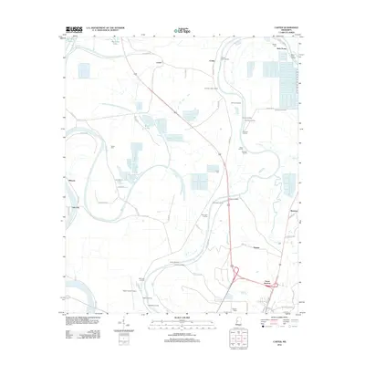
2012 Map of Carter
USGS Topo · Published 2012About this map
The Yazoo River defines the landscape north of Yazoo City, where a dense network of historical river landings once supported the local economy. From Crumps Upper Landing down to Lintonia Landing, these points served as vital connections for agricultural settlements like Carter and Belle Prairie. The terrain is marked by the winding riverbed and oxbow features such as Wilson Lake and the ominously named Dead Man Bayou, illustrating the shifting hydrology of the Delta. Inland, the map reveals a history of family and community through the Brown Cem and Phillips Cem. Transportation patterns are visible in the proximity of Yazoo Junction to the Yazoo County Airport, showing how modern aviation and rail infrastructure overlay the older river-based transport routes that built these small Mississippi communities.
Find a feature on this map
70 named features on this map. Tap any name to fly to it.
Don’t see what you’re looking for? This feature index may not catch every label — zoom into the map to look around manually.
Map Details
Editions of this 2012 Carter Map
This is the sole edition of this map. No revisions or reprints were ever made.
Other maps of this area

1940 · Auter
USGS Topo · 1:62,500

1940 · Mileston
USGS Topo · 1:62,500

1953 · Greenwood
USGS Topo · 1:250,000

1954 · Mileston
USGS Topo · 1:62,500

1955 · Jackson
USGS Topo · 1:250,000

1956 · Greenwood
USGS Topo · 1:250,000

1961 · Jackson
USGS Topo · 1:250,000

1961 · Bayland
USGS Topo · 1:62,500

1961 · Valley
USGS Topo · 1:62,500

1962 · Jackson
USGS Topo · 1:250,000