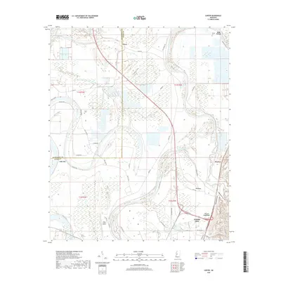
2018 Map of Carter
USGS Topo · Published 2018About this map
The Yazoo River dominates this landscape on the northern edge of Yazoo City, winding through the alluvial bottomlands of the Mississippi Delta. The map shows a region defined by its relationship with water and agriculture, from the oxbow-formed Wilson Lake and Big Kilby Lake to the extensive levee system along Yazoo Levee Rd. Small rural settlements like Carter, Belle Prairie, and Lake City anchor the surrounding farmland, connected by a network of named country roads such as 5 Mile Rd and Wolf Lake Rd. Genealogy researchers can find family landmarks including Phillips Cem and Brown Cem, while transportation history is visible at Yazoo Junction and the Yazoo County Airport. The boundary between Humphreys and Yazoo Counties cuts through the western portion of the sheet, illustrating the local administrative geography.
Find a feature on this map
48 named features on this map. Tap any name to fly to it.
Don’t see what you’re looking for? This feature index may not catch every label — zoom into the map to look around manually.
Map Details
Editions of this 2018 Carter Map
This is the sole edition of this map. No revisions or reprints were ever made.
Other maps of this area

1940 · Auter
USGS Topo · 1:62,500

1940 · Mileston
USGS Topo · 1:62,500

1953 · Greenwood
USGS Topo · 1:250,000

1954 · Mileston
USGS Topo · 1:62,500

1955 · Jackson
USGS Topo · 1:250,000

1956 · Greenwood
USGS Topo · 1:250,000

1961 · Jackson
USGS Topo · 1:250,000

1961 · Bayland
USGS Topo · 1:62,500

1961 · Valley
USGS Topo · 1:62,500

1962 · Jackson
USGS Topo · 1:250,000