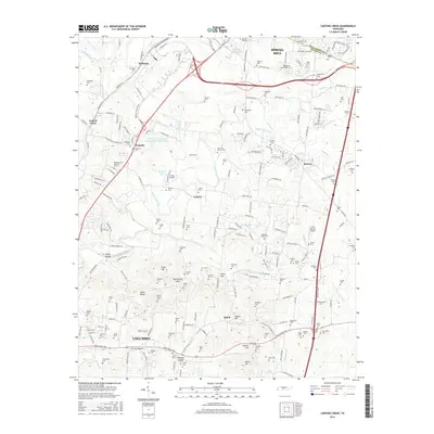
2016 Map of Carters Creek
USGS Topo · Published 2016About this map
Spring Hill and the northern reaches of Columbia dominate this Tennessee landscape, where the convergence of Maury County and Williamson County lines meets a modern transportation network. This era shows the heavy influence of the Saturn Parkway and Interstate corridors on the rural character of the region. Agriculture and research remain prominent at the University of Tennessee Experimental Farm Lake, while the map is densely populated with family-named burial grounds and historic landmarks such as Old Brick Church and Meadow Lawn Memorial Garden. Small communities like Kleburne, Neapolis, and Kedron are interspersed among the ridges and hollows, including Ewing Hollow and Fortner Hollow. Water features such as Rutherford Creek and its many prongs weave through the terrain, supporting the area's transition from traditional farmsteads to suburban development.
Find a feature on this map
216 named features on this map. Tap any name to fly to it.
Don’t see what you’re looking for? This feature index may not catch every label — zoom into the map to look around manually.
Map Details
Editions of this 2016 Carters Creek Map
This is the sole edition of this map. No revisions or reprints were ever made.
Other maps of this area

1901 · Colombia
USGS Topo · 1:125,000

1909 · Franklin
USGS Topo · 1:62,500

1936 · Godwin
USGS Topo · 1:24,000

1936 · Verona
USGS Topo · 1:24,000

1936 · Rally Hill
USGS Topo · 1:24,000

1936 · Spring Hill
USGS Topo · 1:24,000

1936 · Theta
USGS Topo · 1:24,000

1936 · Carters Creek
USGS Topo · 1:24,000

1936 · Glendale
USGS Topo · 1:24,000

1936 · Columbia
USGS Topo · 1:24,000