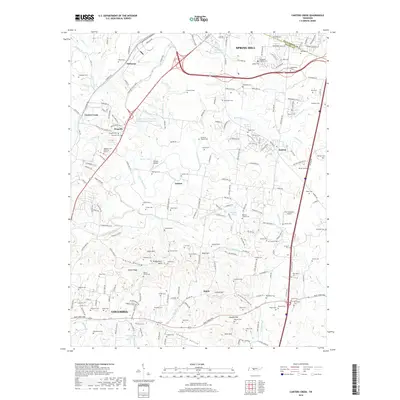
2019 Map of Carters Creek
USGS Topo · Published 2019About this map
Spring Hill and northern Columbia anchor this survey of the Tennessee landscape where Maury Co meets Williamson Co. The area is characterized by a dense network of family-named landmarks and rural burial sites, including the Old Brick Church Cem and Blanton Chapel Cem. Agricultural and institutional land use is prominent, notably the University of Tennessee Experimental Farm Lake near Neapolis. The terrain transitions from the elevations of Aiken Ridge and Rutherford Hills down into the valleys of Ewing Hollow and Cranford Hollow. Aviation infrastructure is represented by the Hunter Airport and R & S Buzzard Airport, while the hydrography is defined by the winding course of Rutherford Creek and its many tributaries like Carters Cr and Double Br. Smaller communities such as Lanton, Kedron, and Kleburne are connected by a modernized road system that includes the Saturn Pkwy and Main St.
Find a feature on this map
217 named features on this map. Tap any name to fly to it.
Don’t see what you’re looking for? This feature index may not catch every label — zoom into the map to look around manually.
Map Details
Editions of this 2019 Carters Creek Map
This is the sole edition of this map. No revisions or reprints were ever made.
Other maps of this area

1901 · Colombia
USGS Topo · 1:125,000

1909 · Franklin
USGS Topo · 1:62,500

1936 · Godwin
USGS Topo · 1:24,000

1936 · Verona
USGS Topo · 1:24,000

1936 · Rally Hill
USGS Topo · 1:24,000

1936 · Spring Hill
USGS Topo · 1:24,000

1936 · Theta
USGS Topo · 1:24,000

1936 · Carters Creek
USGS Topo · 1:24,000

1936 · Glendale
USGS Topo · 1:24,000

1936 · Columbia
USGS Topo · 1:24,000