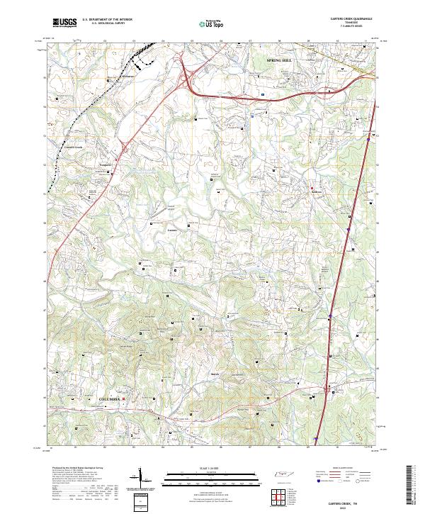
2022 Map of Carters Creek
USGS Topo · Published 2022About this map
Spring Hill and the northern outskirts of Columbia anchor this landscape, where the transition from suburban expansion to rural Tennessee acreage is clearly visible. The area is defined by the rolling drainages of Rutherford Creek and the many forks of Double Br, which carve through a terrain dotted with family-named ridges and hollows like Aiken Ridge and Ewing Hollow. This 2022 survey documents a dense concentration of local history through its many small burial grounds, including the Old Brick Church Cem and Blanton Chapel Cem, which speak to the deep-rooted settlement patterns of the region.
Find a feature on this map
235 named features on this map. Tap any name to fly to it.
Don’t see what you’re looking for? This feature index may not catch every label — zoom into the map to look around manually.
Map Details
Editions of this 2022 Carters Creek Map
This is the sole edition of this map. No revisions or reprints were ever made.
Other maps of this area

1901 · Colombia
USGS Topo · 1:125,000

1909 · Franklin
USGS Topo · 1:62,500

1936 · Godwin
USGS Topo · 1:24,000

1936 · Verona
USGS Topo · 1:24,000

1936 · Rally Hill
USGS Topo · 1:24,000

1936 · Spring Hill
USGS Topo · 1:24,000

1936 · Theta
USGS Topo · 1:24,000

1936 · Carters Creek
USGS Topo · 1:24,000

1936 · Glendale
USGS Topo · 1:24,000

1936 · Columbia
USGS Topo · 1:24,000