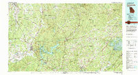
1981 Map of Cartersville
USGS Topo · Published 1982About this map
Etowah Indian Mounds stands near the Etowah River southwest of Cartersville, marking an ancient cultural landscape in a region defined by its complex waterways and mountain ridges. By the early 1980s, this area reflects significant hydraulic development, dominated by the sprawling reaches of Allatoona Lake and the western edge of Lake Lanier. These reservoirs, managed alongside Red Top Mountain State Park, show the transformation of the Georgia Piedmont into a recreational and utility corridor.
Find a feature on this map
142 named features on this map. Tap any name to fly to it.
Don’t see what you’re looking for? This feature index may not catch every label — zoom into the map to look around manually.
Map Details
Editions of this 1981 Cartersville Map
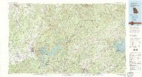
2 editions found
Other maps of this area

1886 · Dalton
USGS Topo · 1:125,000

1886 · Ringgold
USGS Topo · 1:125,000

1886 · Rome
USGS Topo · 1:125,000

1886 · Dahlonega
USGS Topo · 1:125,000

1888 · Ellijay
USGS Topo · 1:125,000

1888 · Atlanta
USGS Topo · 1:125,000

1889 · Tallapoosa
USGS Topo · 1:125,000

1890 · Suwanee
USGS Topo · 1:125,000

1890 · Cartersville
USGS Topo · 1:125,000

1890 · Atlanta
USGS Topo · 1:125,000