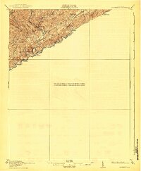
1918 Map of Carterton
USGS Topo · Published 1941About this map
Clinch River carves a deep path through the heart of this Russell County landscape, defining the local geography as it flows past the winding Norfolk and Western railway. At the time of this 1915 survey, small rural hubs like Cleveland and Carterton served as centers of activity for the surrounding mountain hollows. The presence of Clinchfield and the inclusion of topography surveyed for the Clinch Valley National Forest highlight the industrial and natural resource priorities of the era. Higher elevations are marked by landmarks like Grizzly Mountain and the prominent Copper Ridge, while the local social fabric is represented by scattered education sites such as Chaney Fork School and Musick School. The map captures a moment before modern development, where the river, the rail, and the rugged terrain of Sinkhole Valley dictated the placement of settlements and Coulwood PO.
Find a feature on this map
25 named features on this map. Tap any name to fly to it.
Don’t see what you’re looking for? This feature index may not catch every label — zoom into the map to look around manually.
Map Details
Editions of this 1918 Carterton Map
3 editions found

Other maps of this area

1886 · Grundy
USGS Topo · 1:125,000

1890 · Grundy
USGS Topo · 1:125,000

1891 · Tazewell
USGS Topo · 1:125,000

1891 · Abingdon
USGS Topo · 1:125,000

1892 · Grundy
USGS Topo · 1:125,000

1894 · Abingdon
USGS Topo · 1:125,000

1895 · Tazewell
USGS Topo · 1:125,000

1897 · Tazewell
USGS Topo · 1:125,000

1897 · Bristol
USGS Topo · 1:125,000

1902 · Bristol
USGS Topo · 1:125,000