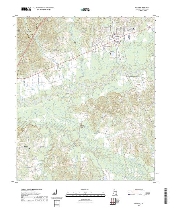
2024 Map of Carthage
USGS Topo · Published 2024About this map
The Pearl River winds through this central Mississippi landscape, defining a terrain of river islands and bayous south of the county seat at Carthage. This modern survey illustrates the persistent rural patterns of the region, where the historic McFaddens Ferry once operated near the junction of Town Creek. Significant genealogy and local history sites are distributed across the hills and bottoms, including the Pilgrim Rest MB Church Cem and the Cedar Grove Cem located near the small settlement of Piggtown.
Find a feature on this map
83 named features on this map. Tap any name to fly to it.
Don’t see what you’re looking for? This feature index may not catch every label — zoom into the map to look around manually.
Map Details
Editions of this 2024 Carthage Map
This is the sole edition of this map. No revisions or reprints were ever made.
Other maps of this area

1953 · Meridian
USGS Topo · 1:250,000

1957 · Meridian
USGS Topo · 1:250,000

1961 · Carthage
USGS Topo · 1:62,500

1962 · Edinburg
USGS Topo · 1:62,500

1962 · Thomastown
USGS Topo · 1:62,500

1965 · Meridian
USGS Topo · 1:250,000

1972 · McAfee
USGS Topo · 1:24,000
1972 · Walnut Grove
USGS Topo · 1:24,000

1984 · Carthage
USGS Topo · 1:100,000
1988 · Thomastown
USGS Topo · 1:24,000