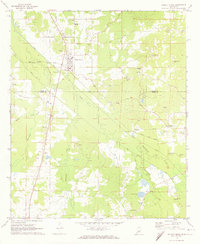
1972 Map of Walnut Grove
USGS Topo · Published 1974About this map
Walnut Grove serves as the primary hub of this landscape, situated along the line of the Gulf Mobile and Ohio railroad. The settlement pattern is defined by the intersection of rail transport and the managed waterways of the Tuscolameta Canal, which cuts a straight path across the winding routes of Tuscolameta Creek and Shockaloo Creek. This era reveals a community deeply rooted in its local institutions, evidenced by the numerous country churches and family burial grounds such as Lindsey Cem and Johnson Chapel Cem that dot the countryside.
Find a feature on this map
36 named features on this map. Tap any name to fly to it.
Don’t see what you’re looking for? This feature index may not catch every label — zoom into the map to look around manually.
Map Details
Editions of this 1972 Walnut Grove Map
This is the sole edition of this map. No revisions or reprints were ever made.
Other maps of this area

1921 · Forest
USGS Topo · 1:48,000

1922 · Forest
USGS Topo · 1:62,500

1922 · Morton
USGS Topo · 1:48,000

1924 · Morton
USGS Topo · 1:62,500

1950 · Forest
USGS Topo · 1:62,500

1951 · Morton
USGS Topo · 1:62,500

1952 · Forest
USGS Topo · 1:62,500

1953 · Meridian
USGS Topo · 1:250,000

1957 · Meridian
USGS Topo · 1:250,000

1961 · Carthage
USGS Topo · 1:62,500