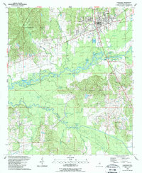
1989 Map of Carthage
USGS Topo · Published 1989About this map
Carthage serves as the regional hub of Leake County in the late 1980s, its street grid expanding south toward the winding corridor of the Pearl River. The landscape reveals a transition from the urban center, marked by institutions like the Hosp and Lincoln Park, to the bottomlands where the river forms complex oxbows and backwaters. Notable water features such as Horseshoe Lake, Flatwood Lake, and Bully Bayou indicate the dynamic nature of this river system. To the west, the Government Hills provide a more elevated, wooded backdrop to the agricultural and residential clearings.
Find a feature on this map
54 named features on this map. Tap any name to fly to it.
Don’t see what you’re looking for? This feature index may not catch every label — zoom into the map to look around manually.
Map Details
Editions of this 1989 Carthage Map
This is the sole edition of this map. No revisions or reprints were ever made.
Other maps of this area

1953 · Meridian
USGS Topo · 1:250,000

1957 · Meridian
USGS Topo · 1:250,000

1961 · Carthage
USGS Topo · 1:62,500

1962 · Edinburg
USGS Topo · 1:62,500

1962 · Thomastown
USGS Topo · 1:62,500

1965 · Meridian
USGS Topo · 1:250,000

1972 · McAfee
USGS Topo · 1:24,000
1972 · Walnut Grove
USGS Topo · 1:24,000

1984 · Carthage
USGS Topo · 1:100,000
1988 · Thomastown
USGS Topo · 1:24,000