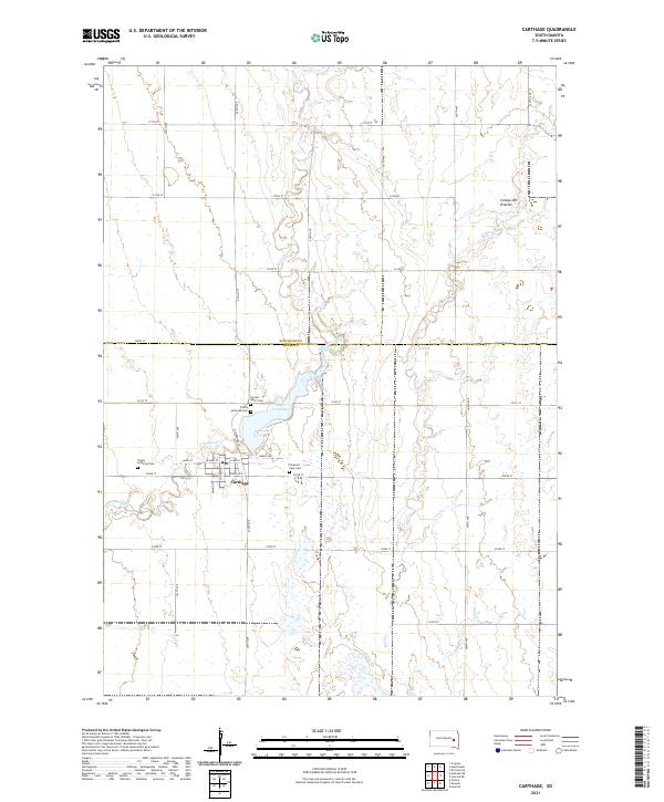
2021 Map of Carthage
USGS Topo · Published 2021About this map
Carthage serves as the focal point of this Eastern South Dakota landscape, situated along the county line between Kingsbury Co and Miner Co. The settlement's layout is clearly defined by local thoroughfares such as Main St, S James St, and N Warehouse St, providing a detailed look at the town's organization. Nearby, the waters of Lake Carthage and the meandering course of Redstone Creek shape the immediate environment, while the broader geography transitions into the Coteau des Prairies to the northeast. Genealogists will find this survey particularly valuable for locating the three distinct burial grounds serving the community: Sacred Heart Cem, Trinity Lutheran Cem, and Pleasant View Cem, all situated on the outskirts of the town proper.
Find a feature on this map
39 named features on this map. Tap any name to fly to it.
Don’t see what you’re looking for? This feature index may not catch every label — zoom into the map to look around manually.
Map Details
Editions of this 2021 Carthage Map
This is the sole edition of this map. No revisions or reprints were ever made.
Other maps of this area

1899 · De Smet
USGS Topo · 1:125,000

1953 · Watertown
USGS Topo · 1:250,000

1958 · Watertown
USGS Topo · 1:250,000

1971 · Iroquois
USGS Topo · 1:24,000

1971 · Howard NE
USGS Topo · 1:24,000

1971 · Fedora
USGS Topo · 1:24,000

1971 · De Smet SE
USGS Topo · 1:24,000

1971 · Artesian NE
USGS Topo · 1:24,000

1971 · Howard
USGS Topo · 1:24,000
1971 · Carthage
USGS Topo · 1:24,000