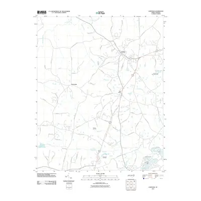
2010 Map of Carthage
USGS Topo · Published 2010About this map
Carthage sits at the heart of this landscape, where a dense network of roads like Pinehurst Ave and Old Glendon Rd converge. The topography is defined by the complex drainages of the Little River and its numerous tributaries, including Killets Creek and Wads Creek. This drainage system has been extensively managed, resulting in a series of named reservoirs such as Long Leaf Lake, Fly Rod Lake, and Thagards Lake.
Find a feature on this map
76 named features on this map. Tap any name to fly to it.
Don’t see what you’re looking for? This feature index may not catch every label — zoom into the map to look around manually.
Map Details
Editions of this 2010 Carthage Map
This is the sole edition of this map. No revisions or reprints were ever made.
Other maps of this area

1942 · Troy
USGS Topo · 1:125,000

1948 · Southern Pines
USGS Topo · 1:62,500

1949 · West End
USGS Topo · 1:24,000

1949 · Jackson Springs
USGS Topo · 1:62,500

1950 · Niagara
USGS Topo · 1:24,000

1950 · Southern Pines
USGS Topo · 1:24,000

1953 · Raleigh
USGS Topo · 1:250,000

1954 · Raleigh
USGS Topo · 1:250,000

1957 · Southern Pines
USGS Topo · 1:62,500
1957 · Southern Pines
USGS Topo · 1:24,000