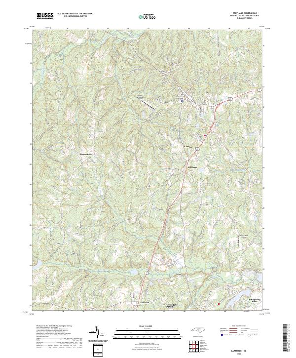
2022 Map of Carthage
USGS Topo · Published 2022About this map
Carthage serves as the focal point of this Moore County landscape, anchored by the Moore County Courthouse and a surrounding network of radial roads that connect the town to outlying communities. The region transitions from the urbanized patterns of Whispering Pines and Eastwood in the southeast to the more dispersed settlements of Hill Crest and Pleasantville. Water defines much of the terrain, with the Little River and its various tributaries like Nicks Cr and Wads Cr carving through the countryside. Aviation history is visible through both the Gilliam-McConnell Airfield and the curiously named Tobacco Road Airport. Smaller water bodies such as Carthage Lake Number Two, Fly Rod Lake, and Long Leaf Lake suggest a landscape managed for recreation and local drainage within the Sandhills region.
Find a feature on this map
143 named features on this map. Tap any name to fly to it.
Don’t see what you’re looking for? This feature index may not catch every label — zoom into the map to look around manually.
Map Details
Editions of this 2022 Carthage Map
This is the sole edition of this map. No revisions or reprints were ever made.
Other maps of this area

1942 · Troy
USGS Topo · 1:125,000

1948 · Southern Pines
USGS Topo · 1:62,500

1949 · West End
USGS Topo · 1:24,000

1949 · Jackson Springs
USGS Topo · 1:62,500

1950 · Niagara
USGS Topo · 1:24,000

1950 · Southern Pines
USGS Topo · 1:24,000

1953 · Raleigh
USGS Topo · 1:250,000

1954 · Raleigh
USGS Topo · 1:250,000

1957 · Southern Pines
USGS Topo · 1:62,500
1957 · Southern Pines
USGS Topo · 1:24,000