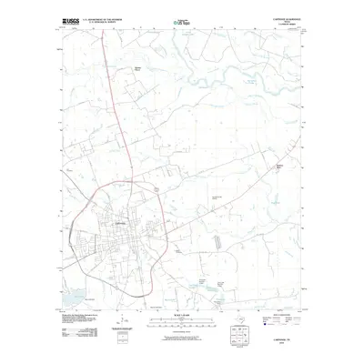
2010 Map of Carthage
USGS Topo · Published 2010About this map
Carthage serves as the focal point of this Panola County landscape, where the urban grid meets the complex hydrology of the Sabine River valley. To the north and east, the river's path is defined by a dense network of secondary waterways including Old River Lakes, The Basin, and Horseshoe Lake, illustrating the shifting nature of the river bottomlands. This 2010 survey shows the town's expansion along routes like W Panola St and S Shelby St, while maintaining connections to its rural surroundings through family and community landmarks. Genealogists will find the locations of Walker Cemetery and Fite Cemetery particularly useful for tracing local lineages. The map also documents modern infrastructure, such as the Panola County Airport and various reservoirs like Dixie Lake and Moore Lake, which mark the transition from the settled town center to the wooded bayous and creeks that characterize this East Texas region.
Find a feature on this map
76 named features on this map. Tap any name to fly to it.
Don’t see what you’re looking for? This feature index may not catch every label — zoom into the map to look around manually.
Map Details
Editions of this 2010 Carthage Map
This is the sole edition of this map. No revisions or reprints were ever made.
Other maps of this area

1943 · Waskom
USGS Topo · 1:62,500

1945 · Waskom
USGS Topo · 1:62,500

1945 · Socagee Bayou
USGS Topo · 1:62,500

1956 · Tyler
USGS Topo · 1:250,000

1956 · Deadwood
USGS Topo · 1:62,500

1958 · Darco
USGS Topo · 1:62,500

1958 · Carthage
USGS Topo · 1:62,500

1962 · De Berry
USGS Topo · 1:24,000

1983 · Grand Bluff
USGS Topo · 1:24,000

1983 · Harris Chapel
USGS Topo · 1:24,000