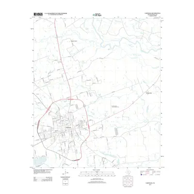
2013 Map of Carthage
USGS Topo · Published 2013About this map
Carthage serves as the regional hub of Panola County, positioned south of the meandering Sabine River and its intricate network of sloughs and bayous. In this 2013 landscape, the city center is defined by the campus of Panola Coll and a grid of residential streets that give way to the Panola County Airport-Sharpe Field to the east. The surrounding countryside is heavily influenced by the riparian geography of The Basin, where features like Bean Lake Slough and Anderson Slough create a complex system of seasonal waterways and wetlands.
Find a feature on this map
130 named features on this map. Tap any name to fly to it.
Don’t see what you’re looking for? This feature index may not catch every label — zoom into the map to look around manually.
Map Details
Editions of this 2013 Carthage Map
This is the sole edition of this map. No revisions or reprints were ever made.
Other maps of this area

1943 · Waskom
USGS Topo · 1:62,500

1945 · Waskom
USGS Topo · 1:62,500

1945 · Socagee Bayou
USGS Topo · 1:62,500

1956 · Tyler
USGS Topo · 1:250,000

1956 · Deadwood
USGS Topo · 1:62,500

1958 · Darco
USGS Topo · 1:62,500

1958 · Carthage
USGS Topo · 1:62,500

1962 · De Berry
USGS Topo · 1:24,000

1983 · Grand Bluff
USGS Topo · 1:24,000

1983 · Harris Chapel
USGS Topo · 1:24,000