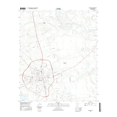
2016 Map of Carthage
USGS Topo · Published 2016About this map
Carthage serves as the focal point of this Panola County landscape, where the urban grid of the county seat meets the complex bottomlands of the Sabine River. The map reveals a community defined by its educational and transport infrastructure, featuring Panola Coll and the Panola County Airport-Sharpe Field. To the north, the small settlement of Walnut Grove sits near the winding course of Irons Bayou. The eastern portion of the survey is dominated by a dense network of riparian features such as Fish Lake Slough, Bean Lake Slough, and The Basin, illustrating the hydrological influence of the river valley. Local history is anchored by sites like Walker Cem and Fite Cem, while numerous small lakes, including Prior Lake Number 1, dot the southern terrain, reflecting the area's rich water resources and traditional land use patterns near the Louisiana border.
Find a feature on this map
119 named features on this map. Tap any name to fly to it.
Don’t see what you’re looking for? This feature index may not catch every label — zoom into the map to look around manually.
Map Details
Editions of this 2016 Carthage Map
This is the sole edition of this map. No revisions or reprints were ever made.
Other maps of this area

1943 · Waskom
USGS Topo · 1:62,500

1945 · Waskom
USGS Topo · 1:62,500

1945 · Socagee Bayou
USGS Topo · 1:62,500

1956 · Tyler
USGS Topo · 1:250,000

1956 · Deadwood
USGS Topo · 1:62,500

1958 · Darco
USGS Topo · 1:62,500

1958 · Carthage
USGS Topo · 1:62,500

1962 · De Berry
USGS Topo · 1:24,000

1983 · Grand Bluff
USGS Topo · 1:24,000

1983 · Harris Chapel
USGS Topo · 1:24,000