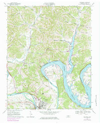
1968 Map of Carthage
USGS Topo · Published 1979About this map
Carthage and South Carthage anchor this bend of the Cumberland River, where the landscape is defined by the massive engineering of the Cordell Hull Lock and Dam. This survey captures the region during a period of transition as the Cordell Hull Lake Reservoir shaped the valley, flooding lowlands near Defeated Creek and creating prominent peninsulas like Horseshoe Bend and Sullivan Bend. To the north, the terrain rises into a network of steep hollows and ridges home to small rural communities such as Difficult, Gravetown, and Monoville. Genealogists can trace local landmarks like Mt Tabor Ch, Parthenia Chapel, and numerous family burial plots such as Dukes Cem. The map also details the local infrastructure of the era, from the Fairgrounds and County High Sch to the industrial presence of a Quarry and a Powerplant near the riverbanks.
Find a feature on this map
73 named features on this map. Tap any name to fly to it.
Don’t see what you’re looking for? This feature index may not catch every label — zoom into the map to look around manually.
Map Details
Editions of this 1968 Carthage Map
2 editions found
Other maps of this area

1928 · Gordonsville
USGS Topo · 1:62,500

1932 · Carthage
USGS Topo · 1:62,500

1942 · Statesville
USGS Topo · 1:100,000

1956 · Corbin
USGS Topo · 1:250,000

1956 · Nashville
USGS Topo · 1:250,000

1958 · New Middleton
USGS Topo · 1:24,000

1958 · Corbin
USGS Topo · 1:250,000

1958 · Dixon Springs
USGS Topo · 1:24,000

1959 · Nashville
USGS Topo · 1:250,000
1959 · Hillsdale
USGS Topo · 1:24,000