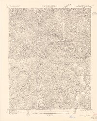
1955 Map of Carvers Gap
USGS Topo · Published 1955About this map
Roan High Knob and Carvers Gap dominate the high ridgelines where the Tennessee-North Carolina border follows the crest of the Blue Ridge. This mid-century survey, based on 1930s field work, captures a transition between high-altitude bald peaks and the industrial valleys below. Mining activity is central to the local economy of the period, with the Jackson Mine, Meadow Mine, and Cranberry Mine scattered among the peaks, reflecting the region's historical reliance on mineral extraction.
Find a feature on this map
44 named features on this map. Tap any name to fly to it.
Don’t see what you’re looking for? This feature index may not catch every label — zoom into the map to look around manually.
Map Details
Editions of this 1955 Carvers Gap Map
This is the sole edition of this map. No revisions or reprints were ever made.
Other maps of this area

1891 · Roan Mountain
USGS Topo · 1:125,000

1893 · Cranberry
USGS Topo · 1:125,000

1894 · Roan Mountain
USGS Topo · 1:125,000

1895 · Cranberry
USGS Topo · 1:125,000

1899 · Cranberry
USGS Topo · 1:125,000

1900 · Mount Mitchell
USGS Topo · 1:125,000

1902 · Cranberry
USGS Topo · 1:125,000

1902 · Mount Mitchell
USGS Topo · 1:125,000

1904 · Roan Mountain
USGS Topo · 1:125,000

1905 · Morganton
USGS Topo · 1:125,000