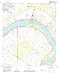
1974 Map of Carville
USGS Topo · Published 1986About this map
The National Leprosarium anchors this stretch of the Mississippi River, marking a unique point of medical history at Carville. This 1970s landscape reveals the complex overlap of river-bottom agriculture and emerging industrial sites between Iberville Parish and Ascension Parish. The river's deep curves create dramatic landforms like Claiborne Island and 81 Mile Point, while the interior is crisscrossed by drainage bayous such as Bayou Braud.
Find a feature on this map
38 named features on this map. Tap any name to fly to it.
Don’t see what you’re looking for? This feature index may not catch every label — zoom into the map to look around manually.
Map Details
Editions of this 1974 Carville Map
2 editions found
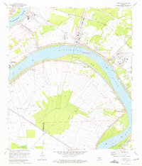
Other maps of this area

1892 · Donaldsonville
USGS Topo · 1:62,500

1908 · Baton Rouge
USGS Topo · 1:62,500

1934 · Denham Springs
USGS Topo · 1:62,500

1935 · Gonzales
USGS Topo · 1:31,680

1936 · White Castle
USGS Topo · 1:62,500

1939 · Denham Springs
USGS Topo · 1:62,500

1939 · Baton Rouge
USGS Topo · 1:62,500

1939 · Donaldsonville
USGS Topo · 1:62,500

1947 · Donaldsonville
USGS Topo · 1:31,680

1953 · Plaquemine
USGS Topo · 1:24,000