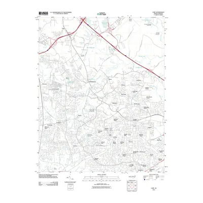
2010 Map of Cary
USGS Topo · Published 2010About this map
Cary and Morrisville anchor this 2010 survey of Wake County, illustrating a landscape of rapid suburban maturation. The map documents an intricate network of residential developments such as Kildaire Farms, Highland Park, and Wellington Park, which filled the spaces between historic transit corridors. The influence of regional infrastructure is evident in the sprawling grounds of the Raleigh-Durham Airport at the northern edge and the smaller Cox Airport to the southwest. Water management features prominently through numerous structures, including the Crabtree Creek W/S Structure Number Two Dam and Hatches Pond Dam. While large-scale commerce and transportation dominate, local history remains visible at sites like Hill Crest Cemetery and the Morrisville Post Office, providing a record of the community's evolution from rural crossroads like Clegg and Carpenter into a key part of the Research Triangle's suburban fabric.
Find a feature on this map
109 named features on this map. Tap any name to fly to it.
Don’t see what you’re looking for? This feature index may not catch every label — zoom into the map to look around manually.
Map Details
Editions of this 2010 Cary Map
This is the sole edition of this map. No revisions or reprints were ever made.
Other maps of this area

1943 · Durham South
USGS Topo · 1:62,500

1943 · Raleigh
USGS Topo · 1:62,500

1951 · Raleigh
USGS Topo · 1:62,500

1951 · Durham South
USGS Topo · 1:62,500

1953 · Raleigh
USGS Topo · 1:250,000

1954 · Raleigh
USGS Topo · 1:250,000

1964 · Lake Wheeler
USGS Topo · 1:24,000

1964 · Garner
USGS Topo · 1:62,500
1967 · Bayleaf
USGS Topo · 1:24,000

1968 · Raleigh West
USGS Topo · 1:24,000