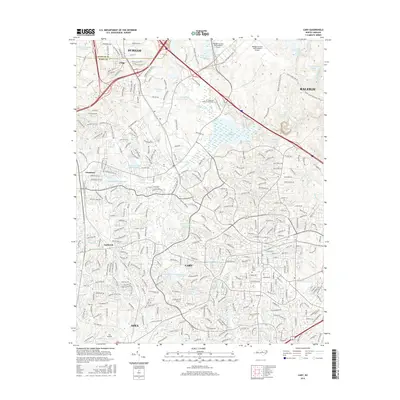
2016 Map of Cary
USGS Topo · Published 2016About this map
Cary and its surrounding growth corridors define this landscape within the Research Triangle, where the borders of Durham Co and Wake Co meet. The map reveals a dense suburban network of residential developments and corporate centers, anchored by the Raleigh-Durham International Airport and the ITT Technical Institute Morrisville. Despite the modern expansion, traces of older rural communities remain visible at Carpenter and Upchurch, alongside established landmarks like Hill Crest Cem.
Find a feature on this map
326 named features on this map. Tap any name to fly to it.
Don’t see what you’re looking for? This feature index may not catch every label — zoom into the map to look around manually.
Map Details
Editions of this 2016 Cary Map
This is the sole edition of this map. No revisions or reprints were ever made.
Other maps of this area

1943 · Durham South
USGS Topo · 1:62,500

1943 · Raleigh
USGS Topo · 1:62,500

1951 · Raleigh
USGS Topo · 1:62,500

1951 · Durham South
USGS Topo · 1:62,500

1953 · Raleigh
USGS Topo · 1:250,000

1954 · Raleigh
USGS Topo · 1:250,000

1964 · Lake Wheeler
USGS Topo · 1:24,000

1964 · Garner
USGS Topo · 1:62,500
1967 · Bayleaf
USGS Topo · 1:24,000

1968 · Raleigh West
USGS Topo · 1:24,000