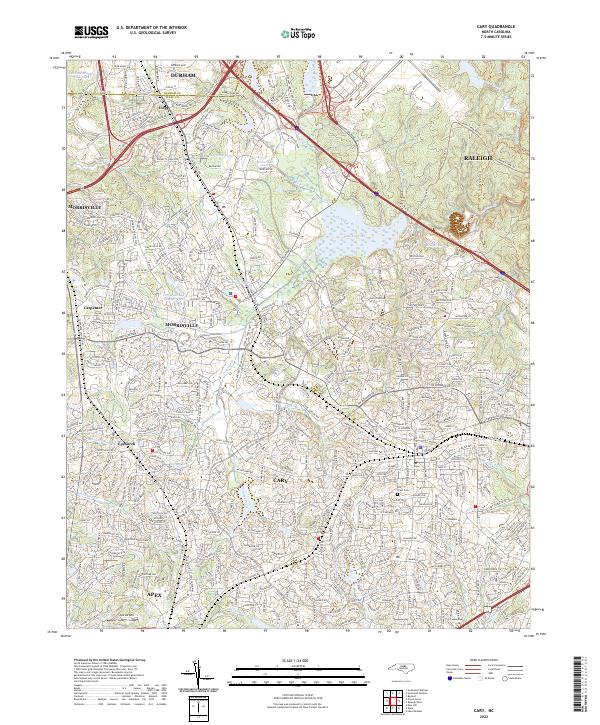
2022 Map of Cary
USGS Topo · Published 2022About this map
The rapid expansion of the Research Triangle is evident across this modern survey of central North Carolina, where the growing municipal boundaries of Cary, Morrisville, and Apex converge. This landscape is a complex network of suburban development and preserved water features, including the sprawling Lake Crabtree and smaller impoundments like Neuseoco Lake and Emily Babcock Lake. The transition from rural roots to modern commerce is marked by older named locations like Carpenter and Upchurch, which are now integrated into the dense residential grid.
Find a feature on this map
150 named features on this map. Tap any name to fly to it.
Don’t see what you’re looking for? This feature index may not catch every label — zoom into the map to look around manually.
Map Details
Editions of this 2022 Cary Map
This is the sole edition of this map. No revisions or reprints were ever made.
Other maps of this area

1943 · Durham South
USGS Topo · 1:62,500

1943 · Raleigh
USGS Topo · 1:62,500

1951 · Raleigh
USGS Topo · 1:62,500

1951 · Durham South
USGS Topo · 1:62,500

1953 · Raleigh
USGS Topo · 1:250,000

1954 · Raleigh
USGS Topo · 1:250,000

1964 · Lake Wheeler
USGS Topo · 1:24,000

1964 · Garner
USGS Topo · 1:62,500
1967 · Bayleaf
USGS Topo · 1:24,000

1968 · Raleigh West
USGS Topo · 1:24,000