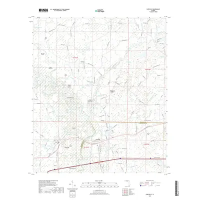
2018 Map of Caryville
USGS Topo · Published 2018About this map
The Choctawhatchee River carves a complex course through this landscape, creating a maze of wetlands including Hickory Tree Flat Slough, Buckhead Slough, and Red Slough. The boundary between Holmes and Washington Counties runs through the heart of the area, centering on the river crossing at Caryville. This river-bottom environment is defined by its numerous named islands and hammocks, such as Canebrake Island, Paul Island, and Hagans Hammock. To the south and west, the settlement of Westville is located near Yellow Slough and the Dead River. Genealogists will find several burial grounds mapped across the rural reaches, including Harris Chapel Cem and Forehand Cem. The northern terrain transitions from river flats into slightly higher ground around the settlement of Gritney and the former site of Hathaway Mill.
Find a feature on this map
142 named features on this map. Tap any name to fly to it.
Don’t see what you’re looking for? This feature index may not catch every label — zoom into the map to look around manually.
Map Details
Editions of this 2018 Caryville Map
This is the sole edition of this map. No revisions or reprints were ever made.
Other maps of this area

1948 · Ponce De Leon
USGS Topo · 1:24,000

1949 · Hinsons Cross Roads
USGS Topo · 1:24,000

1949 · Hobbs Crossroads
USGS Topo · 1:24,000

1949 · Caryville
USGS Topo · 1:24,000

1950 · Hobbs Cross Roads
USGS Topo · 1:24,000

1950 · Prosperity
USGS Topo · 1:24,000

1950 · Ponce De Leon
USGS Topo · 1:24,000

1950 · Hinsons Cross Roads
USGS Topo · 1:24,000

1950 · Caryville
USGS Topo · 1:24,000

1950 · Izagora
USGS Topo · 1:24,000