
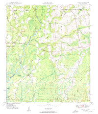
1950 Map of Izagora
USGS Topo · Published 1950About this map
The Choctawhatchee River winds through this 1950 survey, defining the border between Geneva County and Holmes County. This area of the Florida-Alabama line is characterized by river-driven geography, including the distinct Alberson Stretch and various oxbow-adjacent features like Blackfish Lake. Rural life in this period centered around dispersed settlements and faith communities, notably Izagora and Pittman, as well as numerous country churches such as Cedar Grove Ch and New Zion Ch. The landscape is a network of small watercourses like Hominy Creek and Tiger Sikes Creek feeding the larger river system. Local infrastructure of the era is preserved here in the form of Curry Ferry and the Bonifay Highway, showing how residents navigated this water-abundant region before modern bridging was universal.
Find a feature on this map
40 named features on this map. Tap any name to fly to it.
Don’t see what you’re looking for? This feature index may not catch every label — zoom into the map to look around manually.
Map Details
Editions of this 1950 Izagora Map
2 editions found
Other maps of this area

1942 · Enterprise
USGS Topo · 1:125,000

1949 · Hobbs Crossroads
USGS Topo · 1:24,000

1949 · Caryville
USGS Topo · 1:24,000

1950 · Hobbs Cross Roads
USGS Topo · 1:24,000

1950 · Prosperity
USGS Topo · 1:24,000

1950 · Caryville
USGS Topo · 1:24,000

1950 · Esto
USGS Topo · 1:24,000

1951 · Esto
USGS Topo · 1:24,000

1951 · Bonifay
USGS Topo · 1:24,000

1953 · Dothan
USGS Topo · 1:250,000