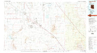
1994 Map of Casa Grande
USGS Topo · Published 1994About this map
The Santa Cruz Flats define the central agricultural and transportation corridor of this Pinal County landscape, where the Southern Pacific railroad and Interstate 10 parallel one another through the desert. This 1994 edition reveals a region transitioning from traditional ranching and mining toward modern suburban growth in Casa Grande and Arizona City. To the north, the Casa Grande National Monument Ruins stands as a preserved archaeological site near Coolidge, while the vast Papago Indian Reservation (Tohono O'odham Nation) and Gila River Indian Reservation occupy the surrounding plains. The map details an extensive irrigation network including the Greene Canal and the Pima Lateral, essential for the survival of settlements like Eloy and Toltec in the arid environment. Rising sharply from the flats, the Picacho Mountains and Silver Reef Mountains contain historic industrial sites such as the Silver Reef Mine.
Find a feature on this map
80 named features on this map. Tap any name to fly to it.
Don’t see what you’re looking for? This feature index may not catch every label — zoom into the map to look around manually.
Map Details
Editions of this 1994 Casa Grande Map
3 editions found
Other maps of this area

1900 · Florence
USGS Topo · 1:125,000

1902 · Florence
USGS Topo · 1:125,000

1904 · Tucson
USGS Topo · 1:125,000

1905 · Tucson
USGS Topo · 1:125,000

1907 · Sacaton
USGS Topo · 1:62,500

1910 · Ray
USGS Topo · 1:62,500

1911 · Winkelman
USGS Topo · 1:125,000

1913 · Winkelman
USGS Topo · 1:125,000

1913 · Maricopa
USGS Topo · 1:62,500

1914 · Gila Butte
USGS Topo · 1:62,500