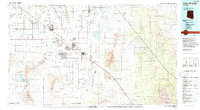
1994 Map of Casa Grande
USGS Topo · Published 1994About this map
The Santa Cruz Flats dominate this mid-1990s landscape, illustrating the complex intersection of ancient history, modern infrastructure, and indigenous lands. The map anchors on the Casa Grande National Monument (Ruins) and the sprawling agricultural corridors of Casa Grande, Eloy, and Coolidge. The desert floor is a network of water management, featuring the Greene Canal, Greene Reservoir, and Picacho Res, which sustain the region's agricultural footprint between the Picacho Mountains and the Tat Momoli Mountains.
Find a feature on this map
66 named features on this map. Tap any name to fly to it.
Don’t see what you’re looking for? This feature index may not catch every label — zoom into the map to look around manually.
Map Details
Editions of this 1994 Casa Grande Map
3 editions found
Other maps of this area

1900 · Florence
USGS Topo · 1:125,000

1902 · Florence
USGS Topo · 1:125,000

1904 · Tucson
USGS Topo · 1:125,000

1905 · Tucson
USGS Topo · 1:125,000

1907 · Sacaton
USGS Topo · 1:62,500

1910 · Ray
USGS Topo · 1:62,500

1911 · Winkelman
USGS Topo · 1:125,000

1913 · Winkelman
USGS Topo · 1:125,000

1913 · Maricopa
USGS Topo · 1:62,500

1914 · Gila Butte
USGS Topo · 1:62,500