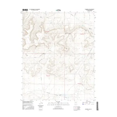
2017 Map of Casamero Lake
USGS Topo · Published 2017About this map
Casamero Lake and the winding Casamero Draw anchor this high-desert landscape in the Eastern Navajo Agency. The terrain is defined by a series of distinct geological formations, including the prominent Red Butte, Wheat Grass Butte, and the expansive White Water Mesa. Water sources, critical for settlement and livestock in this arid environment, are clearly marked at Little Water Spring, Blue Water Spring, and Many Mexican Spring. The map documents a complex network of local transport, from Casamero Lake Loop Rd to various Bureau of Indian Affairs routes like Navajo/ BIA Road 48. Notable natural landmarks such as Cream Colored Rock, Rocky Point, and a depression known as The Cup provide essential orientation points across the canyons and mesas.
Find a feature on this map
33 named features on this map. Tap any name to fly to it.
Don’t see what you’re looking for? This feature index may not catch every label — zoom into the map to look around manually.
Map Details
Editions of this 2017 Casamero Lake Map
This is the sole edition of this map. No revisions or reprints were ever made.
Other maps of this area

1883 · Mt. Taylor
USGS Topo · 1:250,000

1886 · Wingate
USGS Topo · 1:250,000

1886 · Mt. Taylor
USGS Topo · 1:250,000

1892 · Wingate
USGS Topo · 1:250,000

1892 · Mt. Taylor
USGS Topo · 1:250,000

1899 · Mt. Taylor
USGS Topo · 1:250,000

1954 · Gallup
USGS Topo · 1:250,000

1957 · Goat Mountain
USGS Topo · 1:24,000

1958 · Gallup
USGS Topo · 1:250,000

1958 · Albuquerque
USGS Topo · 1:250,000
Featured Places
- Eastern Navajo Agency, NM
- Borrego Pass, NM
- Casamero Lake, Eastern Navajo Agency
- McKinley County, NM
- United States