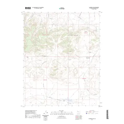
2023 Map of Casamero Lake
USGS Topo · Published 2023About this map
Borrego Pass serves as a primary geographic focus in this high-desert landscape of McKinley County, where the transition between dramatic mesas and lower draws defines the local topography. The map details a network of vital water sources in an arid environment, including Many Mexican Spring, Blue Water Spring, and Little Spring, which likely influenced early movement and settlement patterns. Further south, Casamero Lake and its associated Casamero Draw collect drainage from the surrounding uplands. Named geological features like White Water Mesa, Wheat Grass Butte, and the descriptive Cream Colored Rock provide navigational landmarks for those traversing the complex road system, which includes the Borrego Pass Rd and several Indian Service Routes. For the genealogist, the inclusion of the Borrego Pass Cem provides a specific point of interest for tracing family history in the region.
Find a feature on this map
35 named features on this map. Tap any name to fly to it.
Don’t see what you’re looking for? This feature index may not catch every label — zoom into the map to look around manually.
Map Details
Editions of this 2023 Casamero Lake Map
This is the sole edition of this map. No revisions or reprints were ever made.
Other maps of this area

1883 · Mt. Taylor
USGS Topo · 1:250,000

1886 · Wingate
USGS Topo · 1:250,000

1886 · Mt. Taylor
USGS Topo · 1:250,000

1892 · Wingate
USGS Topo · 1:250,000

1892 · Mt. Taylor
USGS Topo · 1:250,000

1899 · Mt. Taylor
USGS Topo · 1:250,000

1954 · Gallup
USGS Topo · 1:250,000

1957 · Goat Mountain
USGS Topo · 1:24,000

1958 · Gallup
USGS Topo · 1:250,000

1958 · Albuquerque
USGS Topo · 1:250,000
Featured Places
- Eastern Navajo Agency, NM
- Casamero Lake, Eastern Navajo Agency
- Borrego Pass, NM
- McKinley County, NM
- United States