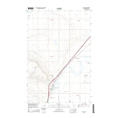
2014 Map of Cascade
USGS Topo · Published 2014About this map
The Missouri River winds through this central Montana corridor, creating a wide valley between the high Cascade Butte and the flatlands of Antelope Flat. This modern topographic study shows the community of Cascade established on the western bank of the river, where several historic roads and local routes like Old US Highway 91 and Simms Cascade Rd converge. Local family history and geography are anchored by the Hillside Cem and the Missouri River Bridge, which serves as a vital crossing point into the broader Chestnut Valley. The landscape is dotted with water management features including the Cascade Reservoir and Rocky Reef Reservoir, while the meandering paths of Little Muddy Cr and Knapp Cr drain the surrounding terrain, illustrating the relationship between the river system and the local ranching or agricultural operations of the early twenty-first century.
Find a feature on this map
34 named features on this map. Tap any name to fly to it.
Don’t see what you’re looking for? This feature index may not catch every label — zoom into the map to look around manually.
Map Details
Editions of this 2014 Cascade Map
This is the sole edition of this map. No revisions or reprints were ever made.
Other maps of this area

1886 · Great Falls
USGS Topo · 1:250,000

1949 · Cascade
USGS Topo · 1:62,500

1951 · Cascade
USGS Topo · 1:62,500

1954 · Great Falls
USGS Topo · 1:250,000

1957 · Great Falls
USGS Topo · 1:250,000

1960 · Simms
USGS Topo · 1:62,500

1961 · Hardy
USGS Topo · 1:24,000

1961 · Rocky Reef
USGS Topo · 1:24,000

1961 · Schrammeck Lake
USGS Topo · 1:24,000
1976 · Great Falls South
USGS Topo · 1:100,000