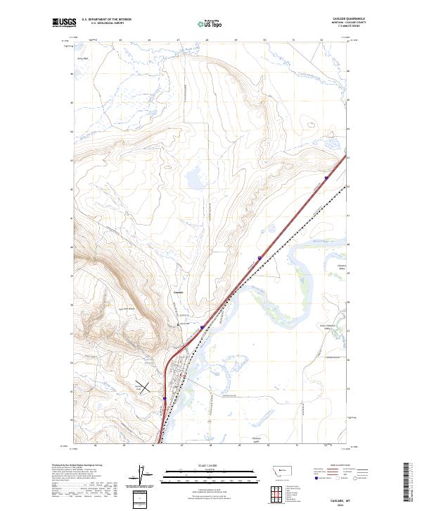
2024 Map of Cascade
USGS Topo · Published 2024About this map
The Missouri River anchors this central Montana landscape, winding through a broad corridor flanked by the Chestnut Valley and Lower Chestnut Valley. The town of Cascade serves as the primary hub, situated near the riverbanks and the distinctive rising terrain of Cascade Butte. This survey highlights the local infrastructure of the modern era, from the residential streets of the town to the recreational and utility features like Cascade Field and the Cascade Reservoir.
Find a feature on this map
37 named features on this map. Tap any name to fly to it.
Don’t see what you’re looking for? This feature index may not catch every label — zoom into the map to look around manually.
Map Details
Editions of this 2024 Cascade Map
This is the sole edition of this map. No revisions or reprints were ever made.
Other maps of this area

1886 · Great Falls
USGS Topo · 1:250,000

1949 · Cascade
USGS Topo · 1:62,500

1951 · Cascade
USGS Topo · 1:62,500

1954 · Great Falls
USGS Topo · 1:250,000

1957 · Great Falls
USGS Topo · 1:250,000

1960 · Simms
USGS Topo · 1:62,500

1961 · Hardy
USGS Topo · 1:24,000

1961 · Rocky Reef
USGS Topo · 1:24,000

1961 · Schrammeck Lake
USGS Topo · 1:24,000
1976 · Great Falls South
USGS Topo · 1:100,000