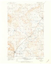
1951 Map of Cascade
USGS Topo · Published 1951About this map
Missouri River hydrology and early mid-century infrastructure dominate this 1951 survey of the Montana heartland. The town of Cascade sits along the river's bend, serving as a hub for the surrounding ranching and rail economy. This map was produced as part of the Department of the Interior program for the development of the Missouri River Basin, an era of significant federal focus on water management. This is evidenced by the numerous irrigation ditches and the Elizabeth Reservoir (Aban'd) north of Rocky Gap.
Find a feature on this map
37 named features on this map. Tap any name to fly to it.
Don’t see what you’re looking for? This feature index may not catch every label — zoom into the map to look around manually.
Map Details
Editions of this 1951 Cascade Map
2 editions found
Other maps of this area

1886 · Great Falls
USGS Topo · 1:250,000

1949 · Cascade
USGS Topo · 1:62,500

1949 · Great Falls
USGS Topo · 1:62,500

1949 · Vaughn
USGS Topo · 1:62,500

1950 · Fairfield
USGS Topo · 1:62,500

1951 · Great Falls
USGS Topo · 1:62,500

1951 · Cascade
USGS Topo · 1:62,500

1952 · Vaughn
USGS Topo · 1:62,500

1954 · Great Falls
USGS Topo · 1:250,000

1955 · Gore Hill
USGS Topo · 1:62,500