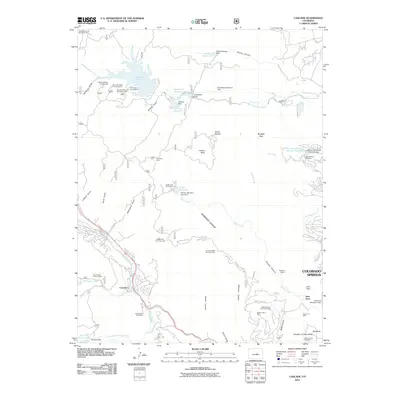
2011 Map of Cascade
USGS Topo · Published 2011About this map
Garden of the Gods anchors the southeastern corner of this landscape, where the high plains meet the steep ascent of the Rampart Range. This 2011 survey captures a complex network of water management and resource extraction tucked into the canyons west of Colorado Springs. The map documents numerous mining sites that speak to the area's geological history, including the Iron King Mine, the Black Canyon Mine, and the Cascade-Ute Pass Mine. The terrain is deeply incised by drainages such as Williams Canyon and Waldo Canyon, while the high country is dominated by the expansive Rampart Reservoir. Modern infrastructure, including the Pikeview Quarry and the Glen Eyrie estate, shows the continuing evolution of land use on the urban fringe, balancing historic preservation with active industry and recreation.
Find a feature on this map
69 named features on this map. Tap any name to fly to it.
Don’t see what you’re looking for? This feature index may not catch every label — zoom into the map to look around manually.
Map Details
Editions of this 2011 Cascade Map
This is the sole edition of this map. No revisions or reprints were ever made.
Other maps of this area

1893 · Platte Canyon
USGS Topo · 1:125,000

1893 · Colorado Springs
USGS Topo · 1:125,000

1894 · Pikes Peak
USGS Topo · 1:125,000

1894 · Castle Rock
USGS Topo · 1:125,000

1901 · Pikes Peak
USGS Topo · 1:125,000

1901 · Pikes Peak
USGS Topo · 1:62,500

1909 · Colorado Springs
USGS Topo · 1:125,000

1913 · Castle Rock
USGS Topo · 1:125,000

1942 · Colorado Springs
USGS Topo · 1:125,000

1948 · Manitou Springs
USGS Topo · 1:24,000