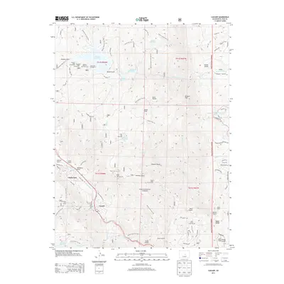
2013 Map of Cascade
USGS Topo · Published 2013About this map
Cascade and Chipita Park sit along the path of Fountain Cr and the Ute Pass corridor, serving as the primary residential hubs in this high-elevation landscape. The terrain is defined by the deep incisions of Williams Canyon and Waldo Canyon, with the eastern edge giving way to the distinctive geological formations of Glen Eyrie, including Kissing Camels and Gate Rock. This 2013 survey illustrates the critical water infrastructure serving the region, from the large Rampart Reservoir in the north to the Manitou Reservoir and Palmer Reservoir. The network of forest roads and trails, such as Rampart Range Rd and the Schubarth Trl, highlights the transition from the protected wilderness of the Pike National Forest to the expanding suburban outskirts of the Colorado Springs area near W Woodmen Rd.
Find a feature on this map
96 named features on this map. Tap any name to fly to it.
Don’t see what you’re looking for? This feature index may not catch every label — zoom into the map to look around manually.
Map Details
Editions of this 2013 Cascade Map
This is the sole edition of this map. No revisions or reprints were ever made.
Other maps of this area

1893 · Platte Canyon
USGS Topo · 1:125,000

1893 · Colorado Springs
USGS Topo · 1:125,000

1894 · Pikes Peak
USGS Topo · 1:125,000

1894 · Castle Rock
USGS Topo · 1:125,000

1901 · Pikes Peak
USGS Topo · 1:125,000

1901 · Pikes Peak
USGS Topo · 1:62,500

1909 · Colorado Springs
USGS Topo · 1:125,000

1913 · Castle Rock
USGS Topo · 1:125,000

1942 · Colorado Springs
USGS Topo · 1:125,000

1948 · Manitou Springs
USGS Topo · 1:24,000