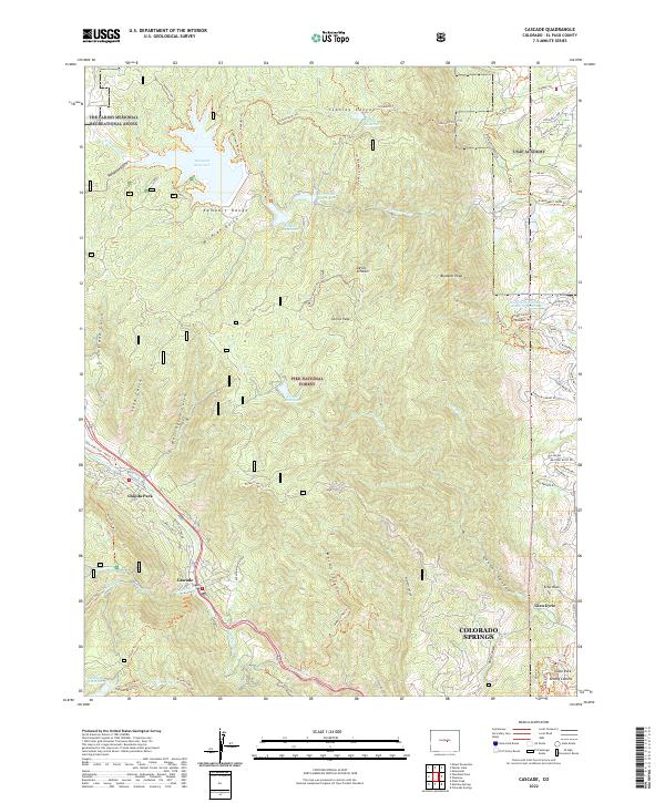
2022 Map of Cascade
USGS Topo · Published 2022About this map
The USAF Academy grounds occupy the northeast portion of this landscape, where the ramparts of the Pike National Forest meet the expanding reach of Colorado Springs. This terrain is characterized by a complex network of high-altitude reservoirs, including Rampart Reservoir, Stanley Reservoir, and Northfield Reservoir, which support the water needs of the Front Range communities below. The map captures the interface between the preserved wilderness of the mountains and the residential developments that climb into the foothills near Glen Eyrie.
Find a feature on this map
95 named features on this map. Tap any name to fly to it.
Don’t see what you’re looking for? This feature index may not catch every label — zoom into the map to look around manually.
Map Details
Editions of this 2022 Cascade Map
This is the sole edition of this map. No revisions or reprints were ever made.
Other maps of this area

1893 · Platte Canyon
USGS Topo · 1:125,000

1893 · Colorado Springs
USGS Topo · 1:125,000

1894 · Pikes Peak
USGS Topo · 1:125,000

1894 · Castle Rock
USGS Topo · 1:125,000

1901 · Pikes Peak
USGS Topo · 1:125,000

1901 · Pikes Peak
USGS Topo · 1:62,500

1909 · Colorado Springs
USGS Topo · 1:125,000

1913 · Castle Rock
USGS Topo · 1:125,000

1942 · Colorado Springs
USGS Topo · 1:125,000

1948 · Manitou Springs
USGS Topo · 1:24,000