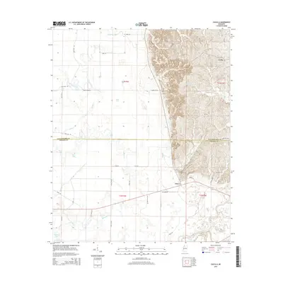
2015 Map of Cascilla
USGS Topo · Published 2015About this map
Cascilla and Oxberry anchor this landscape along the border of Tallahatchie and Grenada Counties, where the Mississippi Delta's flat alluvial plains meet the rising loess bluffs to the east. The southern edge of the map is defined by the winding course of the Yalobusha River, which feeds a complex system of sloughs and wetlands including Maxey Bayou, Vance Bayou, and Blackhawk Pond. This transition between environments is marked by a concentration of rural cemeteries and family sites on the higher ground, such as Stonefield Cem, Saint Peters Cem, and Oxberry Cem. The western lowlands are characterized by an intricate drainage network featuring Wrong Prong, Taylor Cr, and Bear Lake, while the eastern hills provide a more stable foundation for the network of local roads like Pressgrove Rd and Bethel Church Rd. The topographic contrast between the floodplains and Sycamore Flat illustrates the historical challenge of settlement in this river-driven region.
Find a feature on this map
62 named features on this map. Tap any name to fly to it.
Don’t see what you’re looking for? This feature index may not catch every label — zoom into the map to look around manually.
Map Details
Editions of this 2015 Cascilla Map
This is the sole edition of this map. No revisions or reprints were ever made.
Other maps of this area

1932 · Philipp
USGS Topo · 1:48,000

1935 · Philipp
USGS Topo · 1:62,500

1936 · Greenwood
USGS Topo · 1:62,500

1939 · Philipp
USGS Topo · 1:62,500

1940 · Greenwood
USGS Topo · 1:62,500

1953 · Greenwood
USGS Topo · 1:250,000

1953 · West Point
USGS Topo · 1:250,000

1954 · Grenada
USGS Topo · 1:62,500

1954 · McCarley
USGS Topo · 1:62,500

1956 · Greenwood
USGS Topo · 1:250,000