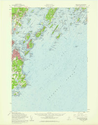
1957 Map of Casco Bay
USGS Topo · Published 1960About this map
Portland and South Portland dominate the coastline in this detailed survey of the southern Maine shore, where the Grand Trunk Railway meets the Fore River. The landscape is heavily marked by maritime defense and public institutions, from the Fort McKinley Naval Res on Great Diamond Island to the U S Marine Hospital and the Maine School for the Deaf on Mackworth Island. These landmarks illustrate the region's strategic importance and its role as a hub for state services during the mid-twentieth century.
Find a feature on this map
107 named features on this map. Tap any name to fly to it.
Don’t see what you’re looking for? This feature index may not catch every label — zoom into the map to look around manually.
Map Details
Editions of this 1957 Casco Bay Map
3 editions found
Other maps of this area

1891 · Portland
USGS Topo · 1:62,500

1891 · Biddeford
USGS Topo · 1:62,500

1892 · Freeport
USGS Topo · 1:62,500

1893 · Biddeford
USGS Topo · 1:62,500

1893 · Small Point
USGS Topo · 1:62,500

1893 · Portland
USGS Topo · 1:62,500

1893 · Casco Bay
USGS Topo · 1:62,500

1894 · Gray
USGS Topo · 1:62,500

1894 · Bath
USGS Topo · 1:62,500

1898 · Gray
USGS Topo · 1:62,500