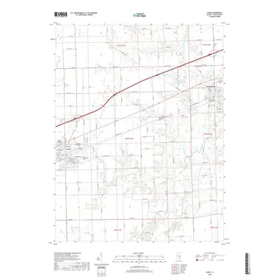
2018 Map of Casey
USGS Topo · Published 2018About this map
The North Fork Embarras River winds through this section of Clark County, defining the drainage patterns that shaped local settlement and agriculture. In the city of Casey, the grid of streets includes names like W Main St and E Alabama Ave, positioned near the Casey Municipal Airport. To the east, Martinsville sits at the junction of several routes, including Co HWY 5. A dense concentration of historical burial grounds, such as Martinsville City Cem, Lincoln Cem, and the Cumberland Baptist Cem, provides significant points of interest for genealogists tracing family ties in the area. The landscape is also dotted with recreational and utilitarian water bodies like Snake Trail Campground Lake and Round Grove Sportsman Lake, while various small tributaries like Quarry Br and Turkey Run dissect the rural fields.
Find a feature on this map
79 named features on this map. Tap any name to fly to it.
Don’t see what you’re looking for? This feature index may not catch every label — zoom into the map to look around manually.
Map Details
Editions of this 2018 Casey Map
This is the sole edition of this map. No revisions or reprints were ever made.
Other maps of this area

1933 · Toledo
USGS Topo · 1:62,500

1936 · Casey
USGS Topo · 1:48,000

1938 · Toledo
USGS Topo · 1:62,500

1940 · Greenup
USGS Topo · 1:62,500

1942 · Casey
USGS Topo · 1:62,500

1943 · Greenup
USGS Topo · 1:62,500

1943 · Casey
USGS Topo · 1:62,500

1953 · Indianapolis
USGS Topo · 1:250,000

1956 · Indianapolis
USGS Topo · 1:250,000

1956 · Annapolis
USGS Topo · 1:62,500