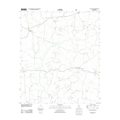
2012 Map of Caseyville
USGS Topo · Published 2012About this map
The Homochitto River meanders across this rural Mississippi landscape, providing a central drainage for numerous tributaries like Hurricane Cr and Slayton Cr. Small communities and family centers such as Caseyville and Pleasant Hill are connected by a network of local roads, including Saint Paul Rd and Caseyville Rd NW. The area is marked by several burial grounds essential for genealogical research, including Ben Salem Cem, Philadelphia Cem, and Mount Moriah Cem. At a higher elevation, the Pleasant Hill Lookout Tower stands near Pleasant Hill Cem, overlooking the diverse terrain of Lincoln County. The map details a transition from river bottoms to upland areas, where many roads like Horse Shoe Loop NW and Buie Mill Rd NW follow the natural contours of the land.
Find a feature on this map
46 named features on this map. Tap any name to fly to it.
Don’t see what you’re looking for? This feature index may not catch every label — zoom into the map to look around manually.
Map Details
Editions of this 2012 Caseyville Map
This is the sole edition of this map. No revisions or reprints were ever made.
Other maps of this area

1953 · Natchez
USGS Topo · 1:250,000

1956 · Natchez
USGS Topo · 1:250,000

1959 · Natchez
USGS Topo · 1:250,000

1963 · Smyrna
USGS Topo · 1:24,000

1963 · Union Church
USGS Topo · 1:62,500

1963 · McBride
USGS Topo · 1:24,000

1963 · Barlow
USGS Topo · 1:24,000

1972 · Midway
USGS Topo · 1:24,000

1972 · McCall Creek
USGS Topo · 1:24,000

1972 · Caseyville
USGS Topo · 1:24,000