
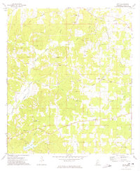
1972 Map of Midway
USGS Topo · Published 1974About this map
Midway and Loyd Star anchor this rural landscape along the boundary of Copiah and Lincoln counties. The map reveals a deeply established community network defined by numerous country churches, including Mt Pisgah Ch, Mercy Seat Ch, and the Latter Day Saints Ch. The terrain is etched by several watercourses such as Providence Creek, Sweetwater Creek, and Bayou Pierre, which help define the agricultural character of the region during the early 1970s.
Find a feature on this map
28 named features on this map. Tap any name to fly to it.
Don’t see what you’re looking for? This feature index may not catch every label — zoom into the map to look around manually.
Map Details
Editions of this 1972 Midway Map
This is the sole edition of this map. No revisions or reprints were ever made.
Other maps of this area

1953 · Natchez
USGS Topo · 1:250,000

1956 · Natchez
USGS Topo · 1:250,000

1959 · Natchez
USGS Topo · 1:250,000

1963 · Smyrna
USGS Topo · 1:24,000

1963 · Hazlehurst
USGS Topo · 1:24,000

1963 · Barlow
USGS Topo · 1:24,000

1972 · McCall Creek
USGS Topo · 1:24,000

1972 · Caseyville
USGS Topo · 1:24,000

1972 · Brookhaven
USGS Topo · 1:24,000
1972 · Zetus
USGS Topo · 1:24,000