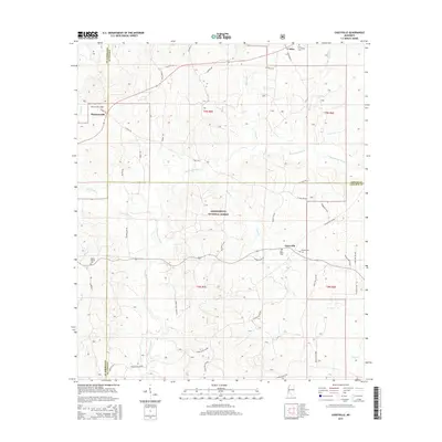
2015 Map of Caseyville
USGS Topo · Published 2015About this map
The Homochitto River meanders through the heart of this landscape, carving a drainage pattern through the Homochitto National Forest and defining much of the local topography. Settlement centers around Caseyville and the smaller community of Allen, connected by a network of rural routes such as Caseyville Rd NW and St Paul Rd. For those researching local family history, several prominent burial grounds are documented, including Ben Salem Cem, Philadelphia Cem, and New Providence Cem. The map illustrates a rural Mississippi environment where small hamlets like Pleasant Hill are framed by a dense system of creeks, including Hurricane Cr, Cedar Cr, and Lick Cr. This document provides a clear view of the area's transition between Copiah, Lincoln, and Jefferson counties, showing the enduring boundaries and road networks that have shaped these forest communities.
Find a feature on this map
50 named features on this map. Tap any name to fly to it.
Don’t see what you’re looking for? This feature index may not catch every label — zoom into the map to look around manually.
Map Details
Editions of this 2015 Caseyville Map
This is the sole edition of this map. No revisions or reprints were ever made.
Other maps of this area

1953 · Natchez
USGS Topo · 1:250,000

1956 · Natchez
USGS Topo · 1:250,000

1959 · Natchez
USGS Topo · 1:250,000

1963 · Smyrna
USGS Topo · 1:24,000

1963 · Union Church
USGS Topo · 1:62,500

1963 · McBride
USGS Topo · 1:24,000

1963 · Barlow
USGS Topo · 1:24,000

1972 · Midway
USGS Topo · 1:24,000

1972 · McCall Creek
USGS Topo · 1:24,000

1972 · Caseyville
USGS Topo · 1:24,000