
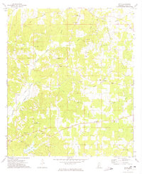
1972 Map of Caseyville
USGS Topo · Published 1974About this map
The Homochitto National Forest occupies the central and southern reaches of this landscape, where the Homochitto River meanders through dense woodlands. This 1970s survey captures the social fabric of the rural intersections between Lincoln, Copiah, and Jefferson counties, defined by a dense network of country churches and family burial grounds. Settled points like Caseyville and Pleasant Hill serve as anchor points for the surrounding community, while the presence of the Lookout Tower suggests the ongoing management of the vast timber resources. Local industry is clearly visible through the numerous Gravel Pit operations scattered across the hills, particularly near Allen in the north. The map traces the natural drainage of the land through Hurricane Creek, Slayton Creek, and Bobs Branch, illustrating how the hydrology dictated the placement of early roads and homesteads.
Find a feature on this map
29 named features on this map. Tap any name to fly to it.
Don’t see what you’re looking for? This feature index may not catch every label — zoom into the map to look around manually.
Map Details
Editions of this 1972 Caseyville Map
This is the sole edition of this map. No revisions or reprints were ever made.
Other maps of this area

1953 · Natchez
USGS Topo · 1:250,000

1956 · Natchez
USGS Topo · 1:250,000

1959 · Natchez
USGS Topo · 1:250,000

1963 · Smyrna
USGS Topo · 1:24,000

1963 · Union Church
USGS Topo · 1:62,500

1963 · McBride
USGS Topo · 1:24,000

1963 · Barlow
USGS Topo · 1:24,000

1972 · Midway
USGS Topo · 1:24,000

1972 · McCall Creek
USGS Topo · 1:24,000
1972 · Zetus
USGS Topo · 1:24,000