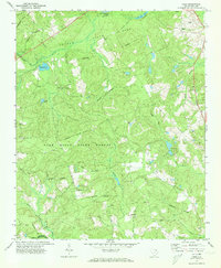
1972 Map of Cash
USGS Topo · Published 1973About this map
The community of Cash sits at the northeastern edge of this landscape, a region defined by the intersection of forest conservation and small-town spiritual life in the early 1970s. The map reveals a high concentration of rural sanctuaries including Macedonia Ch, Bethel Ch, and Edwards Chapel, which serve as landmarks across the transition from the Sand Hills State Forest to the Cheraw State Park. Evidence of earlier transport persists through the Old Railroad Grade and the historic Old Wire Rd, while industrial activity is noted by several pockets of Sandpit and Claypit excavations.
Find a feature on this map
33 named features on this map. Tap any name to fly to it.
Don’t see what you’re looking for? This feature index may not catch every label — zoom into the map to look around manually.
Map Details
Editions of this 1972 Cash Map
This is the sole edition of this map. No revisions or reprints were ever made.
Other maps of this area

1941 · Spartanburg
USGS Topo · 1:250,000

1942 · Rockingham
USGS Topo · 1:125,000

1953 · Florence
USGS Topo · 1:250,000

1953 · Spartanburg
USGS Topo · 1:250,000

1954 · Florence
USGS Topo · 1:250,000

1960 · Spartanburg
USGS Topo · 1:250,000

1963 · Spartanburg
USGS Topo · 1:250,000

1963 · Dovesville
USGS Topo · 1:24,000

1963 · Mont Clare
USGS Topo · 1:24,000

1964 · Spartanburg
USGS Topo · 1:250,000