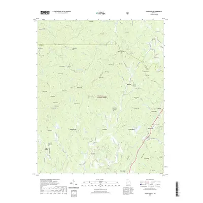
2020 Map of Cashes Valley
USGS Topo · Published 2020About this map
Chattahoochee National Forest dominates the mountainous terrain of the Fannin and Gilmer county line, where high ridges like Horse Ridge and Patterson Mtn overlook deep gaps and narrow valleys. This modern survey captures the enduring network of mountain churches and family burial grounds that anchor the region's genealogy, including the Flat Branch Baptist Church Cem and Mount Pleasant Baptist Church Cem Number 1. Small settlements like Cashes Valley, Santaluca, and Cherry Log are connected by winding roads such as Boardtown Rd and the Benton MacKaye trail. The landscape is defined by its water, from the Ellijay River to Fightingtown Cr, which carve through the elevations near Bushy Head Mtn and White Cliffs. The map provides a precise view of rural infrastructure, tracing Underwood Cem and Salem Baptist Church Cem alongside residential developments and forest service access points.
Find a feature on this map
133 named features on this map. Tap any name to fly to it.
Don’t see what you’re looking for? This feature index may not catch every label — zoom into the map to look around manually.
Map Details
Editions of this 2020 Cashes Valley Map
This is the sole edition of this map. No revisions or reprints were ever made.
Other maps of this area

1886 · Dalton
USGS Topo · 1:125,000

1888 · Ellijay
USGS Topo · 1:125,000

1892 · Ellijay
USGS Topo · 1:125,000

1892 · Dalton
USGS Topo · 1:125,000

1897 · Dalton
USGS Topo · 1:125,000

1898 · Ellijay
USGS Topo · 1:125,000

1911 · Ellijay
USGS Topo · 1:125,000

1911 · Cohutta Mtn
USGS Topo · 1:62,500

1913 · Cohutta Mtn.
USGS Topo · 1:62,500

1914 · Talking Rock
USGS Topo · 1:62,500