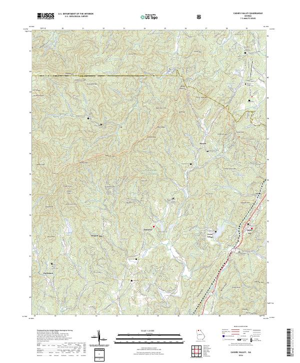
2024 Map of Cashes Valley
USGS Topo · Published 2024About this map
The Chattahoochee National Forest dominates this section of the Southern Appalachians, where steep ridges like Horse Ridge and peaks such as Bear Den Mtn define the local geography. Small settlements and named communities are scattered throughout the valleys, including Cherry Log, Santaluca, and Ai. The map reveals a landscape deeply connected to local family history, evidenced by numerous burial sites like the Golden Cem, Johnson Cem, and Underwood Cem.
Find a feature on this map
190 named features on this map. Tap any name to fly to it.
Don’t see what you’re looking for? This feature index may not catch every label — zoom into the map to look around manually.
Map Details
Editions of this 2024 Cashes Valley Map
This is the sole edition of this map. No revisions or reprints were ever made.
Other maps of this area

1886 · Dalton
USGS Topo · 1:125,000

1888 · Ellijay
USGS Topo · 1:125,000

1892 · Ellijay
USGS Topo · 1:125,000

1892 · Dalton
USGS Topo · 1:125,000

1897 · Dalton
USGS Topo · 1:125,000

1898 · Ellijay
USGS Topo · 1:125,000

1911 · Ellijay
USGS Topo · 1:125,000

1911 · Cohutta Mtn
USGS Topo · 1:62,500

1913 · Cohutta Mtn.
USGS Topo · 1:62,500

1914 · Talking Rock
USGS Topo · 1:62,500