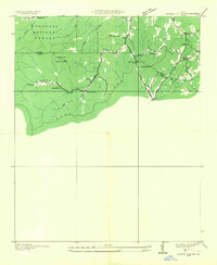
1935 Map of Cashes Valley
USGS Topo · Published 1935About this map
Cashes Valley was a mountain community defined by its remote topography and the winding path of Fightingtown Creek in the mid-1930s. This survey, compiled from aerial photographs by the Tennessee Valley Authority and USGS, reveals a landscape of high ridges like the Blue Ridge and Bush Head Mtn that shaped local settlement patterns. Small centers of life are visible at Cashes Valley Ch and Cashes Valley Sch, while the northern area near the Fannin and Gilmer County line shows the influence of the Cherokee National Forest. The map captures a network of trails and ridge lines connecting isolated homesteads to social hubs like Madola Ch and Youngs Chapel, illustrating the early 20th-century reliance on mountain gaps such as Hickorynut Gap for travel before modern road infrastructure.
Find a feature on this map
21 named features on this map. Tap any name to fly to it.
Don’t see what you’re looking for? This feature index may not catch every label — zoom into the map to look around manually.
Map Details
Editions of this 1935 Cashes Valley Map
This is the sole edition of this map. No revisions or reprints were ever made.
Other maps of this area

1886 · Dalton
USGS Topo · 1:125,000

1888 · Ellijay
USGS Topo · 1:125,000

1892 · Ellijay
USGS Topo · 1:125,000

1892 · Dalton
USGS Topo · 1:125,000

1897 · Dalton
USGS Topo · 1:125,000

1898 · Ellijay
USGS Topo · 1:125,000

1911 · Ellijay
USGS Topo · 1:125,000

1911 · Cohutta Mtn
USGS Topo · 1:62,500

1913 · Cohutta Mtn.
USGS Topo · 1:62,500

1914 · Talking Rock
USGS Topo · 1:62,500