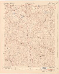
1947 Map of Cashiers
USGS Topo · Published 1947About this map
Cashiers and its surrounding valleys sit at a critical hydrological juncture along the Tenn Blue Ridge, where the headwaters of the Chattooga River and Horsepasture River begin their descent toward the Atlantic and the Gulf. This 1947 survey captures a landscape of scattered mountain settlements such as Nicholson, Hampton, and Bohaynee connected by winding roads through the Nantahala National Forest. The map detail reveals the deep-rooted family history of the region, marked by the Upper Zachary Cem, Lower Zachary Cem, and Norton Cem. Cultural life is anchored by local institutions like Montvale Sch and Pleasant Grove Ch. Large recreational water bodies, including Fairfield Lake and Sapphire Lake, contrast with the steep, unnamed slopes of Hogback Mountain and Chimneytop Mtn, illustrating the mid-century transition from subsistence mountain life toward its modern character as a woodland retreat.
Find a feature on this map
89 named features on this map. Tap any name to fly to it.
Don’t see what you’re looking for? This feature index may not catch every label — zoom into the map to look around manually.
Map Details
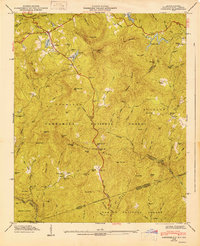
Editions of this 1947 Cashiers Map
2 editions found
Other maps of this area

1886 · Walhalla
USGS Topo · 1:125,000

1888 · Pickens
USGS Topo · 1:125,000

1891 · Cowee
USGS Topo · 1:125,000

1892 · Walhalla
USGS Topo · 1:125,000

1894 · Pickens
USGS Topo · 1:125,000

1896 · Walhalla
USGS Topo · 1:125,000

1897 · Cowee
USGS Topo · 1:125,000

1905 · Pisgah
USGS Topo · 1:125,000

1906 · Pisgah
USGS Topo · 1:125,000

1907 · Cowee
USGS Topo · 1:125,000