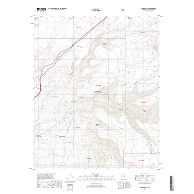
2018 Map of Casner Butte
USGS Topo · Published 2018About this map
Rimrock serves as a primary settlement point in this high-desert landscape within the Coconino National Forest. The map reveals a complex network of ranching and water infrastructure essential to the region, marked by numerous named tanks such as Apache Maid Tanks and John Henry Tank. The terrain is defined by deep incisions like Rarick Canyon and Casner Canyon, which surround prominent landmarks including Casner Butte and the culturally significant Sacred Mtn. The reliance on natural water sources and early trails is evident, with Wet Beaver Cr and Soda Spring providing critical water in an otherwise arid environment. Ranching history is anchored by the Ward Ranch, while old transportation routes like Apache Maid and Bell trace the movements of early settlers and forest rangers through the canyons and across the mesas of central Arizona.
Find a feature on this map
63 named features on this map. Tap any name to fly to it.
Don’t see what you’re looking for? This feature index may not catch every label — zoom into the map to look around manually.
Map Details
Editions of this 2018 Casner Butte Map
This is the sole edition of this map. No revisions or reprints were ever made.
Other maps of this area

1887 · Verde
USGS Topo · 1:250,000

1892 · Verde
USGS Topo · 1:250,000

1923 · Camp Verde
USGS Topo · 1:125,000

1932 · Camp Verde
USGS Topo · 1:125,000

1936 · Camp Verde
USGS Topo · 1:125,000

1954 · Holbrook
USGS Topo · 1:250,000

1957 · Holbrook
USGS Topo · 1:250,000

1958 · Holbrook
USGS Topo · 1:250,000

1960 · Holbrook
USGS Topo · 1:250,000
1965 · Munds Mountain
USGS Topo · 1:24,000